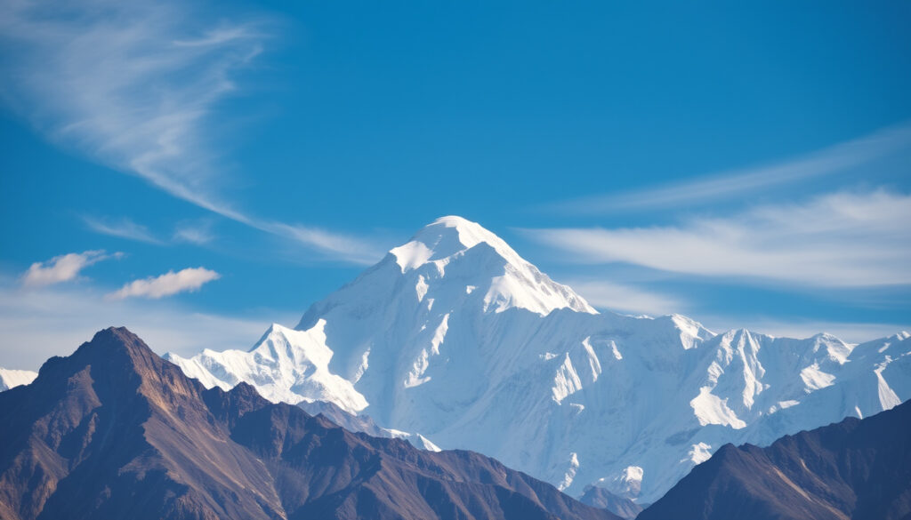
Highest Mountain in the World – Height, Location & Facts
Mount Everest stands as Earth’s highest mountain above sea level, reaching 8,848.86 meters at its summit. Located on the border between Nepal and China’s Tibet Autonomous Region, this iconic peak has captivated explorers, climbers, and scientists for centuries. Understanding its precise measurements, geographic context, and historical significance provides clarity on why Mount Everest holds its distinguished position among the world’s mountains.
The question of which mountain holds the title for highest in the world requires careful examination of measurement standards. Above-sea-level elevation serves as the primary metric used by geographers and cartographers, though other measurements such as base-to-peak height and distance from Earth’s center offer alternative perspectives. Mount Everest has held its position as the highest peak since accurate global measurements became possible, though the exact figure has been refined numerous times through increasingly sophisticated surveying techniques.
What Is the Highest Mountain in the World?
Mount Everest, known as Sagarmāthā in Nepal and Qomolangma in Tibet, claims the title of world’s highest mountain when measured from sea level. The 2020 joint survey conducted by China and Nepal established the current official height at 8,848.86 meters, accounting for variables such as snow cap depth and the geological effects of the 2015 Nepal earthquake.
Mount Everest
Height
8,848.86 m (29,031.7 ft)
Location
Nepal–China border
First Ascent
May 29, 1953
Several key facts distinguish Mount Everest from other candidates for the title of highest mountain. The measurement standard used—height above mean sea level—reflects the global consensus among cartographic authorities. Alternative metrics sometimes surface in popular discussions, but above-sea-level elevation remains the internationally recognized standard.
- Official height of 8,848.86 meters established by joint China-Nepal survey in 2020
- Height includes snow cap, which can vary seasonally by several meters
- Rock height, without snow, measures approximately 8,844 meters according to Chinese surveys
- Everest’s summit temperature can drop below minus 35°C during winter months
- The mountain rises approximately 3,600 meters above the surrounding Tibetan Plateau on its northeast face
- Despite common belief, Everest is not the tallest mountain when measured from base to peak
- Geological activity in the Himalayas continues to influence the region’s topography
| Fact | Detail |
|---|---|
| Official Height | 8,848.86 meters (29,031.7 feet) |
| Prominence | 8,848 meters above sea level |
| Mountain Range | Himalayas, Mahalangur Himal sub-range |
| Coordinates | 27°59′18″N 86°55′31″E |
| Local Names | Sagarmāthā (Nepal), Qomolangma (Tibet) |
| First Confirmed Summit | May 29, 1953 |
How Tall Is Mount Everest?
The precise height of Mount Everest has been debated, measured, and refined since British surveyors first calculated its elevation in the mid-nineteenth century. Understanding these measurement standards requires examining how different nations and scientific bodies have approached the challenge of quantifying the world’s highest point.
Understanding Height Measurement Standards
Surveying Mount Everest presents unique technical challenges. The summit sits at extreme altitude where oxygen levels drop dramatically, weather conditions change rapidly, and physical access remains limited to brief climbing windows. These factors have contributed to varying measurements over the decades. According to research documented in encyclopedic sources, early measurements relied on triangulation from distant survey stations, while modern techniques employ GPS technology and gravity measurements.
The distinction between rock height and snow cap height has been a point of discussion between Nepal and China. Nepal traditionally includes the snow cap in its measurements, while China has advocated for reporting the rock summit separately. The 2020 joint survey resolved this discrepancy by establishing a comprehensive figure that satisfies both perspectives.
Why Has Everest’s Height Changed on Paper?
Incremental adjustments to Everest’s recorded height reflect improvements in surveying technology rather than physical changes to the mountain itself. The 2015 Nepal earthquake raised questions about whether the mountain had shifted, prompting the coordinated international survey effort that produced the currently accepted figure. Reference materials on global geography document how earlier surveys, including those conducted during British colonial rule, provided the foundational measurements upon which subsequent refinements were built.
Where Is Mount Everest Located?
Mount Everest occupies a dramatic position along the border separating Nepal from China’s Tibet Autonomous Region. The mountain rises within the Mahalangur Himal, a subrange of the Greater Himalayas, at coordinates 27°59′18″N 86°55′31″E. This precise geographic positioning places the summit on the main Himalayan crest, marking the divide between two distinct physiographic regions.
The Mountain Range Context
The Himalayas stretch across approximately 2,400 kilometers, forming a natural barrier between the Indian subcontinent and the Tibetan Plateau. Within this vast mountain system, Everest stands as the highest peak among more than 100 mountains exceeding 7,300 meters in elevation. Geographic reporting highlights how Everest’s prominence influences both regional weather patterns and the cultural significance of the surrounding areas.
Surrounding peaks define Everest’s immediate neighborhood within the Mahalangur Himal. Lhotse rises to 8,516 meters just south of the summit, while Nuptse, Khumbutse, and Changtse complete the ensemble of notable peaks clustered in the area. The proximity of these major summits creates a complex alpine environment where climbers navigate between objectives during expedition seasons.
Access and Climbing Routes
Two primary approach routes enable access to Everest’s summit. The Southeast Ridge route ascends from the Nepali side through the Khumbu Icefall and Western Cwm, while the Northeast Ridge route climbs from Tibet. Both paths demand technical climbing skills, proper acclimatization, and substantial logistical support. The mountain’s extreme altitude presents physiological challenges that climbers must manage carefully to avoid life-threatening conditions.
Is Mount Everest the Highest from Base to Peak?
The answer depends entirely on how height is measured. While Everest ranks first when elevation above sea level serves as the metric, alternative measurements reveal different winners. This distinction addresses a common point of confusion that arises when comparing mountains using varying standards.
Base-to-Peak Comparisons
Mauna Kea in Hawaii surpasses Everest when measuring from underwater base to summit. From its origin on the Pacific Ocean floor, Mauna Kea rises more than 10,200 meters, significantly exceeding Everest’s base-to-peak measurement of approximately 3,650 to 4,650 meters depending on which base elevation is selected. Ocean service documentation confirms that most of Mauna Kea’s height remains hidden beneath the ocean surface.
When measuring distance from Earth’s center, Chimborazo in Ecuador actually extends farther into space than Everest due to the equatorial bulge. This occurs because Earth is not a perfect sphere but bulges at the equator. Chimborazo’s summit reaches 6,384.4 kilometers from Earth’s center, approximately 2,168 meters farther than Everest’s summit.
Denali and Other Notable Comparisons
Denali in Alaska, formerly known as Mount McKinley, presents another case where base-to-peak height exceeds Everest’s measurement. With a base-to-peak elevation of approximately 5,300 to 5,900 meters, Denali presents a more dramatic vertical relief when measured from its immediate base compared to Everest’s more gradual approach from surrounding terrain. These comparisons illustrate why context matters when discussing mountain height rankings.
History of Mount Everest Summits and Height Changes
The documented history of Everest’s measurement and ascent reflects evolving scientific capabilities and human ambition. Surveying expeditions began in the nineteenth century, while summit attempts accelerated through the twentieth century until the ultimate goal was achieved in 1953.
- 1856: British Great Trigonometrical Survey designated the peak as Peak XV and calculated its elevation at 8,840 meters.
- 1952–1954: Survey of India measured the summit at 8,847.73 meters using triangulation methods.
- 1953: Edmund Hillary of New Zealand and Sherpa Tenzing Norgay completed the first confirmed ascent on May 29 via the Southeast Ridge route.
- 1975: Chinese survey teams measured the peak at 8,848.13 meters including snow cap.
- 2005: China announced a rock height measurement of 8,844.43 meters.
- 2010: Nepal and China agreed on 8,848 meters as the official height, with both nations accepting different measurement approaches.
- 2015: A major earthquake in Nepal raised questions about potential height changes, prompting new survey efforts.
- 2020: A joint China-Nepal survey established the current official height at 8,848.86 meters, incorporating earthquake effects and improved measurement technology.
The question of whether Everest has grown taller over time lacks definitive evidence. While the Himalayan mountain range continues to experience tectonic uplift, any increases occur extremely slowly—measured in millimeters per year at most. The perceived height changes over the past century and a half reflect refinement of measurement techniques rather than actual mountain growth. Per a més informació sobre el Mont Everest, visiteu Medaller de Jo 2026 Milano Cortina.
What We Know for Certain About Everest’s Height
Distinguishing established facts from areas of ongoing scientific uncertainty helps clarify public understanding of Everest’s measurements. The following comparison outlines areas of consensus alongside matters that remain subjects of continued research.
| Established Information | Remaining Uncertainties |
|---|---|
| Official height of 8,848.86 meters as of 2020 | Long-term geological uplift rate |
| Height exceeds all other mountains above sea level | Precise impact of climate change on snow coverage |
| Located on Nepal-China international border | Future measurement survey schedules |
| First summited in 1953 by Hillary and Norgay | Effects of continued mountaineering traffic on summit integrity |
| Height varies with snow cap conditions | Permanent height changes from seismic activity |
Snow cap depth varies seasonally and annually, meaning the precise summit elevation can fluctuate by roughly half a meter depending on accumulation conditions. Survey teams typically measure during specific seasons to minimize this variable, but complete standardization remains challenging.
Understanding Everest’s Place in Geography and Culture
Mount Everest’s significance extends beyond geographic measurements into cultural, spiritual, and symbolic dimensions. For the Sherpa people of Nepal and the indigenous communities of Tibet, the mountain holds profound religious meaning as a sacred site rather than merely a climbing objective.
The mountain’s prominence in global consciousness has transformed the surrounding region into a major destination for adventure tourism and scientific research. Documented expeditions continue to provide opportunities for studying high-altitude physiology, climate patterns, and geological processes that cannot be observed elsewhere at such extreme elevations.
International cooperation has become essential for managing Everest’s resources and ensuring climber safety. The mountain straddling two nations requires coordinated approaches to conservation, rescue operations, and climbing permits. Climate change impacts, including glacier retreat and increased rockfall risk, have added urgency to these collaborative efforts in recent years.
What Experts Say About Mount Everest
Scientific and geographic authorities consistently affirm Everest’s status based on established measurement standards. Survey organizations from multiple nations have contributed data supporting the current consensus height.
The joint survey conducted by China and Nepal in 2020 represents the most comprehensive effort to date, combining modern GPS technology with traditional survey methods to establish a precise measurement that accounts for multiple variables including snow cap depth and gravitational anomalies.
Geographic publications and encyclopedic references document the mountain’s characteristics based on peer-reviewed surveys and official measurements. Reference materials on global landmarks provide detailed accounts of the measurement history and geographic context that inform current understanding.
Everest remains the preeminent alpine destination, attracting hundreds of climbers annually while continuing to serve as a natural laboratory for studying atmospheric conditions, geological processes, and human adaptation to extreme environments.
Key Takeaways About the World’s Highest Mountain
Mount Everest’s position as the world’s highest mountain above sea level remains firmly established based on international survey consensus. The currently accepted height of 8,848.86 meters reflects the most sophisticated measurement approach in the mountain’s history of documentation.
Understanding Everest requires recognizing that different measurement standards yield different rankings. Base-to-peak height, distance from Earth’s center, and above-sea-level elevation each tell only part of the mountain’s story. The cultural and scientific significance of the peak continues to grow as access improves and research capabilities expand.
For those interested in exploring related topics about wildlife and natural environments or cultural and religious traditions, additional resources provide context for understanding how humans interact with remarkable natural landmarks across the globe.
Frequently Asked Questions
Has Mount Everest grown taller over time?
The Himalayan region experiences ongoing tectonic uplift, but any increase in Everest’s height occurs at rates measured in millimeters per year. Most historical height changes reflect improved measurement techniques rather than actual mountain growth.
What is the highest mountain when measured from base to peak?
Mauna Kea in Hawaii exceeds Everest in base-to-peak measurement. Rising more than 10,200 meters from the Pacific Ocean floor, it surpasses Everest’s approximately 4,650-meter base-to-peak elevation.
Who was the first person to climb Mount Everest?
New Zealander Edmund Hillary and Sherpa Tenzing Norgay completed the first confirmed summit of Mount Everest on May 29, 1953, via the Southeast Ridge route from the Nepali side.
Why do different sources report slightly different heights for Everest?
Variations occur because measurements may include or exclude snow cap depth, use different reference points, or employ varying surveying technologies. The 2020 joint survey established a comprehensive figure of 8,848.86 meters.
What mountain range is Mount Everest located in?
Mount Everest lies within the Mahalangur Himal sub-range of the Greater Himalayas, spanning the border between Nepal and China’s Tibet Autonomous Region at coordinates 27°59′18″N 86°55′31″E.
Is there a higher mountain than Everest?
When measured above sea level, no mountain exceeds Everest’s 8,848.86-meter height. However, Mauna Kea is taller from base to peak, and Chimborazo extends farther from Earth’s center due to the planet’s equatorial bulge.
What caused the 2020 height revision?
The 2015 Nepal earthquake prompted questions about potential height changes. The joint China-Nepal survey employed modern GPS technology and accounted for gravitational anomalies and snow cap conditions to establish the most precise measurement yet achieved.
More related posts
 Kelly Clarkson Weight Loss: How She Lost 60 Lbs Fast
 NHL Mock Draft 2026 – Top Prospects and Projections
 Royal Bank of Canada Login: How to Access Your Account
 Tampa Bay Rays vs Toronto Blue Jays Timeline: Full History
 Gold Price in India – Live 24K and 22K Rates Today
 Mahesh Babu: Wealth, Family, and Tollywood Career
 Scott Disick: Net Worth, Family, and Life Updates
 Sunjay Kapur: Death, Inheritance Feud and Bee Rumor Explained
